
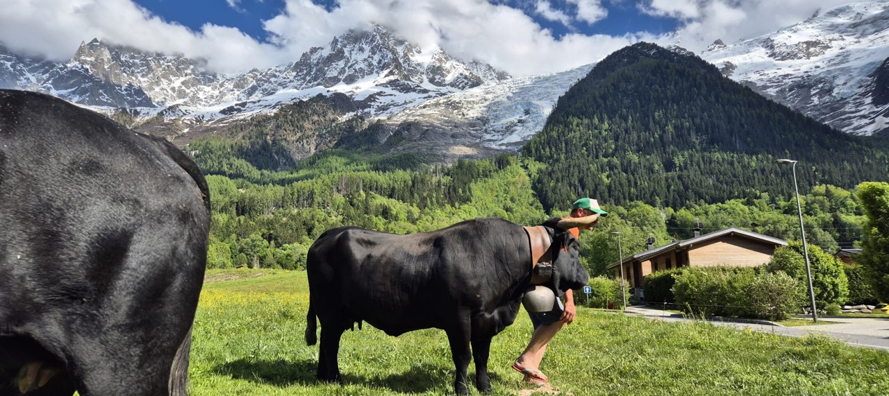
Software and hardware for free-range livestock monitoring
Welcome to the App-écho website.
A herd monitoring application designed with farmers
Based in Plan-les-Ouates, in the canton of Geneva, Alpes-éco Schweiz AG develops the App-écho: a combination of connected devices, multi-screen applications and tailored services.
Now the Swiss leader, the App-écho owes its reputation to the new generations of devices we design, GPS trackers and behavioural analysis, products known for their ergonomics and their resistance, and to the innovations born from several years of research.
In short: a few devices, one application, an accessible service. Rental, package or purchase, the formula adapts to your farm.
An application designed to meet the challenges of pastoralism

Labour shortage
Geo-Zone entry and exit alerts replace the round. A pasture that no longer justifies a shepherd stays in use: you go up when the application tells you, not before.
Climate change
High-resolution satellite imagery is at your disposal to follow the state of the pastures. The THI, the heat stress index, is computed live for every animal. The locomotor energy cost measures what the terrain really costs your animals.
Use conflicts
The prevention system handles on its own the sharing of your Official Geo-Zones with the public maps. Hikers see the zone, the warning, and walk around. An extra layer of safety, with nothing more to do.
Predation
We detect situations we consider at risk, and the AI can help you protect and defend yourself: it locates the crossings and the times.
GPS trackers, tags and sensors for your animals and your equipment
For your animals as for your equipment, we offer a wide range, from GPS trackers and measuring tags to the anti-theft tracker: we design every device ourselves, from the housing to the embedded software, and fit the communication technology that works where you are, 4G, LoRa or satellite.
What sets them apart, point by point.
Ergonomics
Offered in several housing formats and in different sizes.
Battery life
Our devices are known for their battery life, among the longest on the market.
Sending frequency
From 140 to 7,000 messages per day.

Additional components
Accelerometer, Bluetooth gateway.

Firmware
Our mastery of the firmware sets us apart. Beyond the GPS position, you collect a large amount of information.
 Made in Switzerland
Position, altitude, activity, weather: the data received with every message
Here is a real transmission from a Tracking Prime, as it appears in your application once processed by our calculators. The position is given to within 1 or 2 m. Each line is a piece of data we measured, corrected or computed.
| Item | Value | Description |
|---|---|---|
| Animal status | ||
| Animal type | 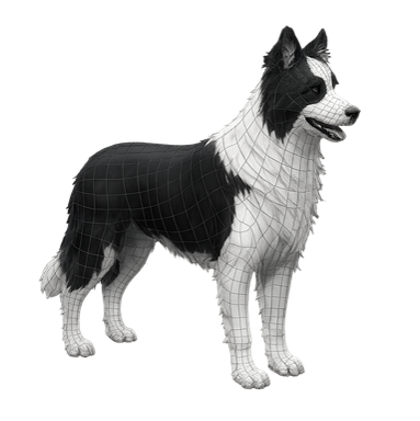 | Cattle, sheep, goats, horses, guardian dogs and herding dogs. |
 Activity Activity | Repos | Depending on the device: the T-Border tells you whether the animal is moving or resting; the higher ranges measure the intensity and characterise the risk. |
 Altitude Altitude | 2185 m | Corrected by our server, accuracy of 1 m. |
 GPS distance GPS distance | 312 m | How many metres the animal covered between two messages. |
 Elevation Elevation | 24 m | How many metres of elevation between two messages. |
| DDL | 214 s | Locomotion time between two positions. |
 Direction Direction | 161° S | Where the animal is going, or looking, right now. |
| Environmental status | ||
 Weather temp. Weather temp. | 15.3 °C | The temperature right now, at the animal's altitude. |
 Hygrometry Hygrometry | 41 % | The humidity right now, at the animal's altitude. |
 Pressure Pressure | 834 hPa | The pressure right now, at the animal's altitude. |
 THI THI | 59, Comfort | The heat stress level, at every new measurement. |
 Conditions Conditions | Partly cloudy | The weather conditions of the moment. |
Everything is refreshed at every measurement.
The monitoring application on smartphone, tablet and computer
One application, three screens: smartphone, tablet, computer. Every version is complete. The computer goes further: the season's history, heavy analyses, 3D modules, management of the organisation.
As simple as it is technical, and we will not lie to you: mastering the whole software takes several weeks. The everyday modules, though, are learned in a few minutes. Everyone moves at their own pace, and no one moves alone: every module opens onto its tutorial, and Heidi is there.
Our youngest user is 12 years old. The oldest is 81.
Not a Swiss army knife, a real toolbox.

Live 2D
Your animals and your devices on the map, live.

Geo-Zones
Your plots and your prevention Geo-Zones, drawn on the map.

Routes
Where each animal went, day by day.

Notifications
The alerts that matter, pushed to your phone.
The analysis modules take more time. Three levels:

The four everyday modules.

Animations, 3D routes, interactions, Live 3D.

Performances, CEL, fidelity, prevention, guardian dogs.
The maps. Everything included, in 2D as in 3D.
40 base maps in all, from satellite to national map by way of relief. On top, layers we lay ourselves. Behind it, the same engines as the world's largest mapping platforms, working for your alp.

40 base maps
From satellite to national map, in 2D and in 3D.
Hiking trails
The Swiss trails, with closures and detours, and the international trails.

Overlays
Summits, cadastre, roads and paths, lakes and rivers, drawn by us, on any view.
Live weather
Temperature, humidity, pressure and heat stress at your animals' exact location.
An unmatched choice of base maps.
 Alpes-éco
 Cesium Ion
 Mapbox
 swisstopo
Heidi, the AI designed for free-range farming
You open the application, ask a question, and she answers about your animals, not in generalities. Heidi knows which screen you are on and shows you the button to click, with its real image. You ask her for an analysis, she really runs it on your data: locomotor energy cost, performances, routes, interactions, herd fidelity. Once the computation is done, you pick the hat, farmer, economist, shepherd, climate, and she reads the same figures again from that angle.
She knows your farm: your species, your guardian dogs, your terrain, the predation pressure in the area. What matters to you, she knows before she speaks.
She does not talk about an average pasture. She talks about yours.
Designed, coded and hosted by Alpes-éco, in Europe. Four languages, every module, computer as phone. She reads your data, she never modifies it.
High-resolution satellite imagery included: your pastures seen from the sky
We manufacture our own satellite imagery, on our servers, tile by tile. The Sentinel-2 images of the European Copernicus programme are reconstructed in very high resolution by an artificial intelligence before any computation, then draped over the terrain. You see which part of your pasture still carries grass, which is drying out, and where the water sits, without climbing up.
It is available on almost every map in the application, with the Satellite button. No quota, no usage limit, no extra cost. Still in beta, it keeps improving.
Seeing what the eye cannot.
True colour
Your pasture as it is, untouched. Only the sharpness is reconstructed.
Grass vigour
NDVI, ten shades of green to read grass quality finely, paddock by paddock.
False colour
The foresters' and agronomists' view: vegetation in red, water in black, mineral in grey.
Open water
NDWI: lakes, pools, waterlogged ground. Watching a water point shrink through the summer.
Foliage moisture
NDMI, the one that looks ahead: the plant dries from the inside long before it yellows.
Exit, incursion and at-risk activity alerts: indicators and methods
One glance is enough.
On the maps, animals and equipment are shown as icons, coloured according to their activity. At a glance you know everything: green, all is in order; purple, the animal is resting; orange, something is going on. Simple, for an easy start.
 Your animals
 Your equipment
Mastering the indicators and methods takes time. That is the Confirmed and Expert level.
Behavioural indicators
Sending a position is something everyone can do. The App-écho works out what that position means.
VAI, absolute intensity value
It is with this mathematical formula that we characterise the activity of each animal in four levels.
CEL, locomotor energy cost
The real locomotion effort, over time.
Methods
The others tell you activity is high or low. We tell you what the animal is doing, and whether it is serious.
SPE, severity, probability, exposure
A calculation method that takes in more than 41 parameters and the last weeks of activity of each animal.
The judge
An AI that takes the decision to alert you, and tells you why.
Becoming a client: the écho space, reserved for professionals
This site is not an online shop. The App-écho is sold only to professionals: farmers, alpine pastures, organisations. And at Alpes-éco, we are selective. We do not deliver equipment, we enter into a relationship. Before any order, we look at everything: your network coverage, your animals, your terrain, your real needs. If the App-écho is not the right answer for you, we will tell you.
Support is personalised. When you are ready, the écho space awaits you at the bottom of this page.
We wish you a pleasant visit.

Explore
Visit the site: the IoT devices, the software, the prevention system, the user guide. Take the time to understand the App-écho before contacting us.

Identify yourself
The écho space is the secure part of the site. Already a customer: sign in with Google or with the link received by email. First time: request access; after a pre-registration, the next steps reach you by email.

Build your request
The catalogue, prices in CHF or EUR, a simulation of your costs and the basket. You choose, you send.

Receive your offer
We study your request, you receive a tailored offer by email. You accept it, we do the rest.
Eligible countries
Our services are offered in selected countries only.
 Switzerland
 France
 Germany
 Austria
 Italy
Italy