écho prevention
The official system for collecting, processing and distributing prevention Geo-Zones. The canton declares, the federal authority validates, the farmer refines it on the ground, and the public receives the information in the app they already use. One chain, from the ground to the national map.
Right now in Switzerland
Official Geo-Zones
active right now
Feed updated at
Deployed at federal level for livestock guardian dogs, écho prevention covers three further domains with the same mechanics. Only the content published and what triggers the Geo-Zone change.

Livestock guardian dogs
The most sensitive encounter for the public. It knows where the dogs are working and how to behave.

Nursing cows
A herd with calves reacts differently. The Geo-Zone warns before entry into the pasture.

Wildlife
Quiet areas, nesting sites, birthing periods. Here prevention protects the animal rather than the human.

Protected flora
Rare stations, fragile habitats. The Geo-Zone opens and closes on the seasonal calendar, with no animal involved.
écho prevention carries this chain end to end, from the cantonal declaration through to publication on the national mapping portal and in the hiking apps. The platform holds no authority over the data: it collects, processes and distributes, under the control of the federal office which answers for it.
écho prevention is an application of the écho system. It draws on its resources, its infrastructure and its calculation engines, while forming a self-contained framework that can be deployed on its own. That is what makes country-scale prevention affordable: the backbone already exists. Close to three years of development were needed to bring it to this level.


The risk
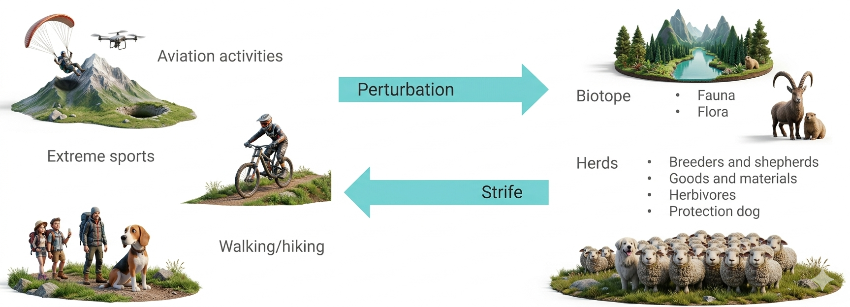
In the mountains, pastoral activity, wildlife, flora and tourism share the same ground. Without reliable information, an encounter becomes a conflict.
The public does not know it is entering a guarded sector, the farmer does not know where the trails run, and the dog does the work it is there for.
Rare compared with the number of encounters, incidents are still enough to weaken the acceptance of livestock guardian dogs.
The Swiss cheese model
Every safety barrier has holes. As long as they do not line up, the incident does not happen.
Training, awareness, signage: the barriers already exist, each with its weaknesses. The sign does not say whether the animals are there today.
écho prevention adds one more, without replacing the others: the right information, in the right place, at the right time.
One more barrier, not one instead of the others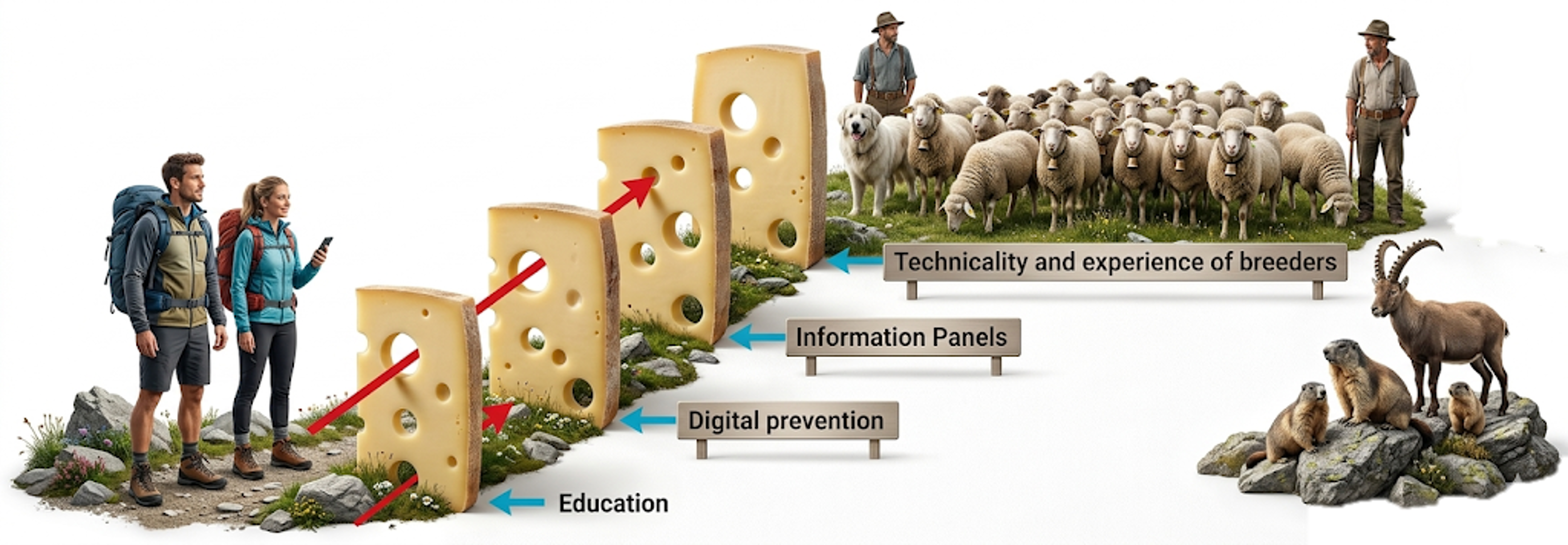
Everyone gets something out of it
A prevention framework that is imposed always ends up being worked around. This one holds because the public has nothing to do, the farmer gains tools, and the authority keeps control.
The public does nothing
It downloads no prevention app, and never will. The information comes to it, inside the hiking apps it already uses.
It is the only strategy that truly reaches the public. Launching a dedicated app means funding an audience that will not show up.

The farmer gets a lot
Satellite imagery of his pastures, full mapping of his alp, assistance and tutorials. For those who own collars, the tracking of their animals comes on top.
And because he is already there, he plays the prevention game. It costs him nothing extra, in time or in money.

The government keeps control
Control over what is published, and over the purpose of the data. It stays their data, and they decide its use and its recipients.
Distribution, on the other hand, is our trade. We run the interfaces, and the country deals with neither infrastructure, nor formats, nor load.
The chain, step by step
One origin, one processing stage, one destination. Nothing is lost on the way and every stage has a named owner.
1
The farmer draws
2
The canton submits
3
The FOEN validates
4
The Geo-Zone becomes official
5
The farmer refines and activates
6
écho prevention distributes
Drawing a Geo-Zone and submitting it
The same screen, the same control panel, but not the same rights. This part of the work is done from the desktop version.




The farmer prepares his Geo-Zone
He draws his perimeter on the map, names it, chooses its type, then links it to his super user, usually his canton's administration. He confirms, and his work stops there.
The submit button does not appear on his screen at all. He prepares, he does not submit. Nobody can push a Geo-Zone to the federal authority by accident.
The cantonal administration submits
The same screen, the same panel. But for an authorised super user at cantonal level, the submit button is active.
It takes the Geo-Zone prepared by the farmer, completes it with the information meant for the public, and submits it straight to the federal office. Responsibility for what goes out stays with the administration.
The canton submits in seconds
No file to put together, no deadline to wait for. The canton takes the Geo-Zone prepared by the farmer and sends it to the federal level, at any point in the year.
Choose the prevention type.
State the presence period in full words.
Add whatever information it already has, if any.
Submit.
The super user is already filled in, there is nothing to touch. And whatever is missing blocks nothing: the sentinel completes and corrects afterwards.
Submit at any time, in seconds

The decision and the distribution rest with the Confederation
A Geo-Zone submitted by a canton does not become official by default. From validation through to distribution, every link stays in the hands of the federal authority.
Accepted
The submission becomes an official Geo-Zone, with everything it carried. It then enters the public flow and becomes visible to the public.
Refused
The submission goes back with its refusal status. The canton keeps its Geo-Zone and can rework it, but it is never published until it has been accepted.
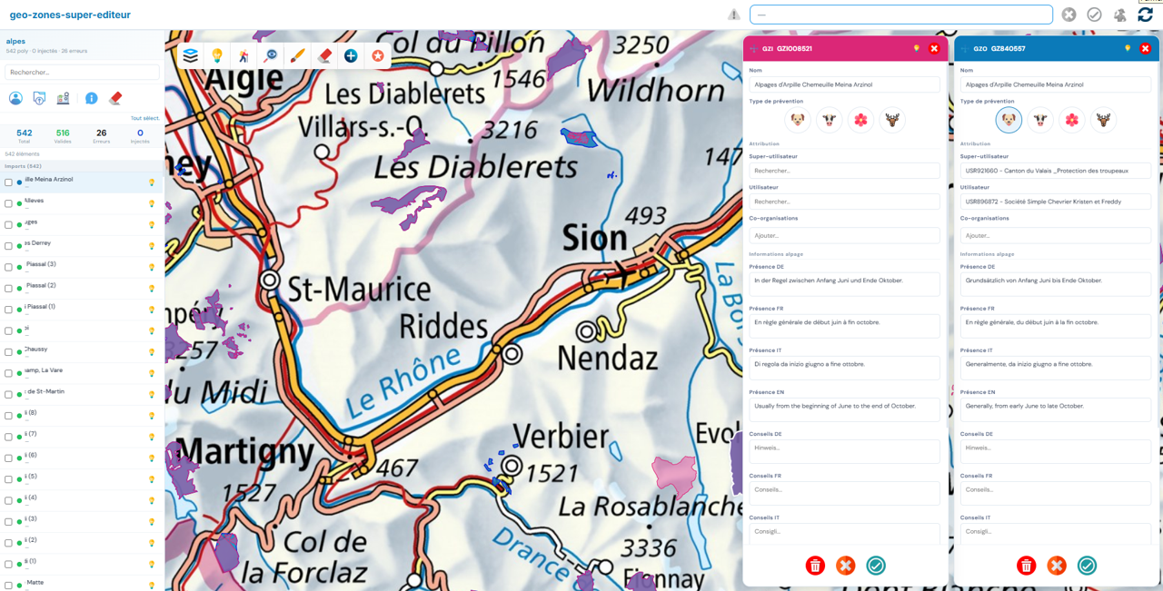
The Geo-Zone super editor
A single tool, available to the federal office alone through its secure area. Everything happens there, from the incoming file to publication.
The cantons' files arrive in sessions, each with its own live count.
A check across the whole session separates what is usable from what needs reworking.
The outline is reworked vertex by vertex, before publication.
Name, prevention type, responsible farmer, texts in four languages, all entered in one pass.
Downward to the farmer, upward into the public flow.

The ground is documented too
Beyond the Geo-Zones, the tool records dated and located points. That is what links physical prevention with digital prevention.
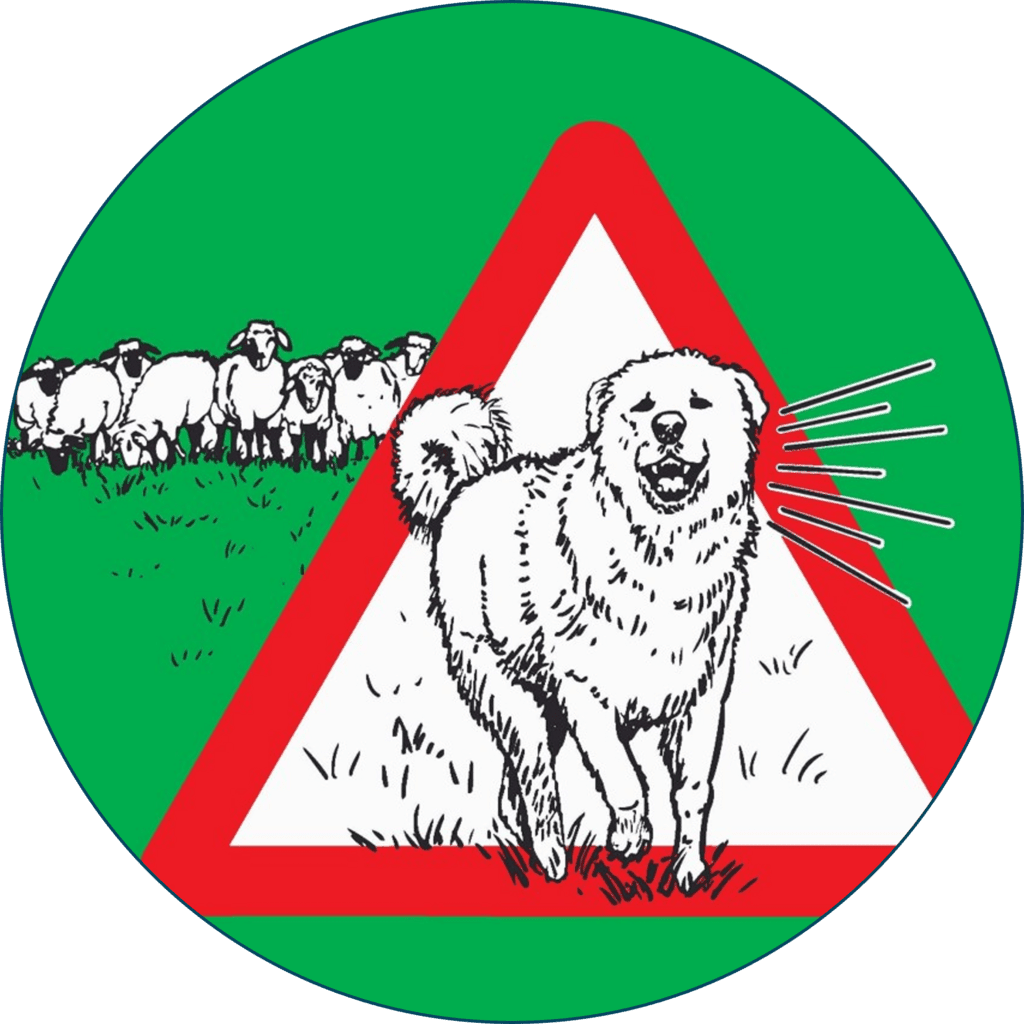
Warning signs
Every sign that is put up is recorded at its exact position, with its date. You finally know where the physical information actually stands on the ground, and since when.

Incidents
An incident is logged in the same place, dated, located and tied to the organisation that entered it. That gives a usable history instead of cases reported one at a time.

Distribution stays in the authority's hands
Control does not stop at validating the Geo-Zones. From its management console, the federal office sees what is being distributed, sets the distribution parameters and can suspend it, without going through us.
It sees what goes out
Everything distributed is logged and can be reviewed: when, to which recipient, with what result. Nothing leaves the system without leaving a trace.
It sets the distribution
The country chooses what it publishes, to whom, and at what pace. National mapping portal, hiking apps, alert systems, cantonal services: each recipient gets what concerns them, and the settings are changed from the console.
It can suspend
Distribution can be interrupted at any time, by the authority alone. Nothing starts again until it has decided so, and resuming is its call as well.
Two autonomous engines
The core never stops. Around it, two independent engines run continuously, day and night, across the whole country, with no day-to-day intervention.
The sentinel
It watches over every Geo-Zone in the territory. It switches a Geo-Zone on as soon as presence is established on the ground, and off as soon as it ends. It also maintains the data itself: what is missing gets completed, what exists in one language only is brought into line across all four. A Geo-Zone is never silent because nobody took care of it.
The exporter
It produces and publishes what the public will see, continuously. Before every publication, it checks what it is about to send. If the result is not compliant, it refuses to publish: the last valid version stays online, the public map is never degraded, and those responsible are alerted straight away, even if the rest of the platform is down.
On the ground it shows plainly: a Geo-Zone lights up when it should, and goes dark when there is no longer any reason for it. Seasonal calendar, actual presence of the animals or a decision by the farmer, whatever the source, the public map follows on its own.
The farmer switches his Geo-Zones on at any time
It all plays out in the field. From his phone when he is up on the alp, or from his computer on the way down. The same screen, the same map, and a decision that reaches the public map straight away.
An official Geo-Zone can cover hundreds of hectares. In a few clicks the farmer marks out the sector actually concerned, then chooses how it switches on. Four ways, two of them with nothing to do at all.
Alpage de Loveignoz


 Layers
 Draw
Draw Eraser
 Move
Move Display

Automatic activation through geo-detection
The mode where the farmer has nothing left to do. The animals themselves tell the system where they are, and the public map follows.

Officially deployed with the Canton of Valais, and privately in other cantons.
Every livestock guardian dog is compatible with the system, whether it falls under a cantonal programme or is privately held.
Nothing to set up, nothing to forget
The Geo-Zone switches on when the dogs are working there and off when they have gone. No calendar to keep, no box to tick before going up, nothing forgotten on the way down. The farmer takes care of nothing; the system handles it alone, end to end.
A public map that is always right
The public sees the Geo-Zone flagged only when it truly is. A Geo-Zone lit all season while the herd is elsewhere ends up not being believed, and the warning loses its value on the very day it matters.
A record of what happened
Every switch-on and switch-off is dated. Without having asked for it, the farmer ends up holding a record of what was flagged and when.

Are Alpes-éco collars mandatory?
No. The prevention framework works without any equipment, and automatic activation can rely on position data coming from other systems. The integration terms are set out on the dedicated page.
What the farmer who plays along receives
No connected device is needed. A farmer without a single collar receives the full set of field tools, in return for his commitment to prevention alone.
The map of his alp
National base maps, satellite view, relief, official hiking trails and closures in force, points of interest and predator reports. He sees his ground and what happens on it, with nothing to install.
High-definition satellite imagery
Five readings of his pastures, processed on our servers: true colour, vigour of the vegetation, false colour, water and vegetation moisture. Enough to judge the grass before going up, and to follow the season week by week.

Heidi, the assistant
Reachable at any time on four themes: predators, climate, herd management, economics. She answers in the farmer's own language and opens the matching tutorial when useful.

The tutorials
Every module has its illustrated tutorial, in the four languages, opened straight from the application. Nothing is left to guesswork, the prevention configurator included.
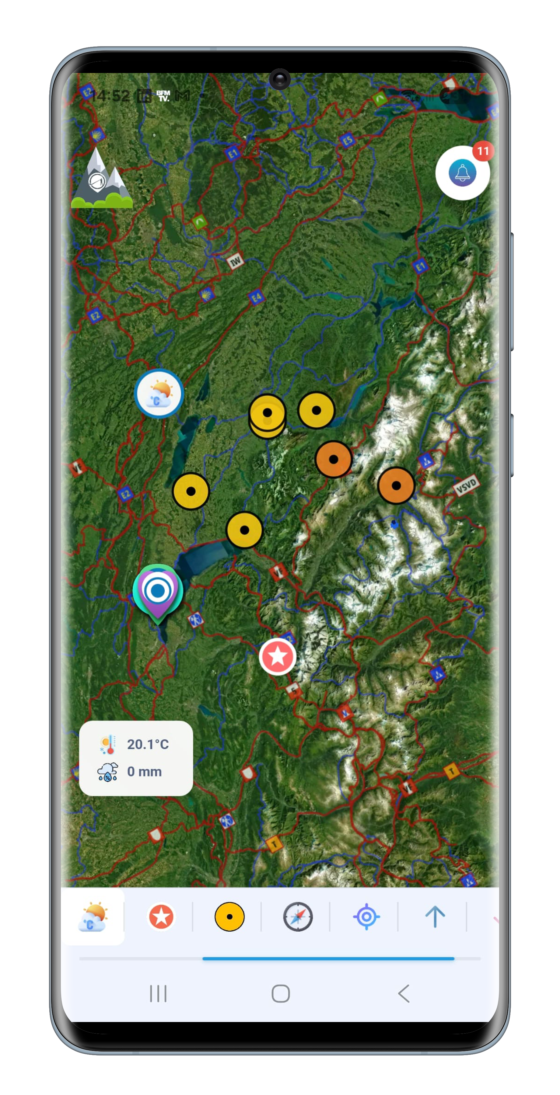
The map of the alp
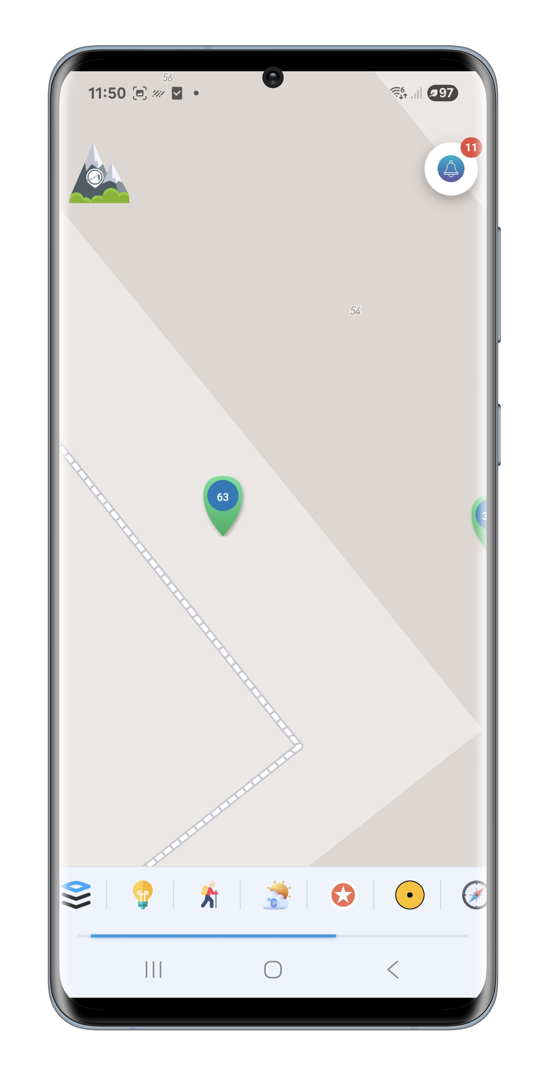
The satellite imagery
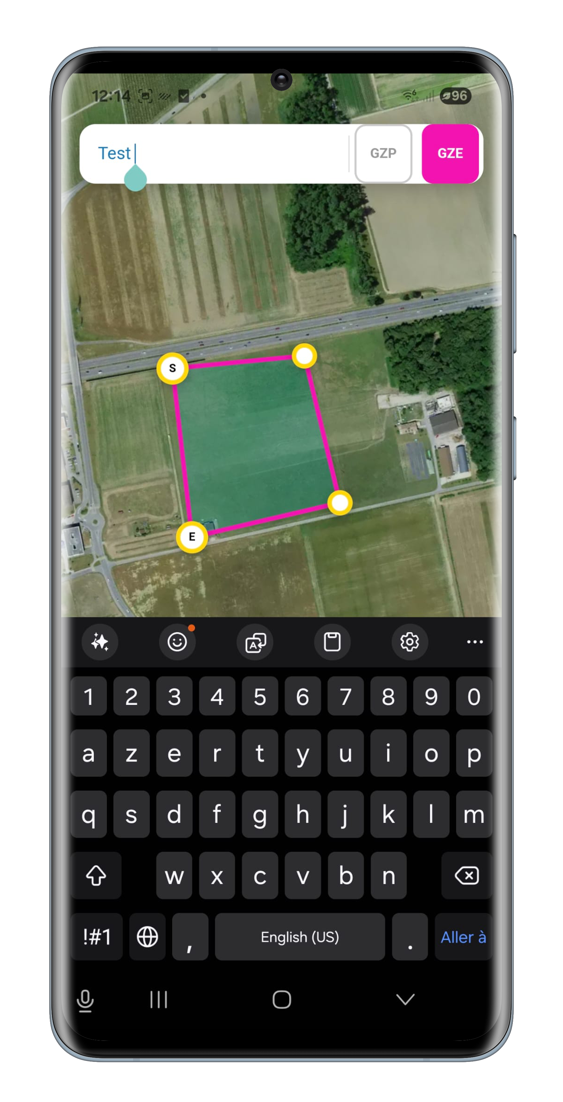
The prevention configurator
A single source, easy to integrate
The country does not have to change its tools. The flow plugs into the platforms already in place.

Standard formats of the field
GeoPackage, GeoJSON and KML, in the national coordinate system. No proprietary format, no dependency on our interface.

The system would rather stay silent than say something false
A detection is only accepted after confirmation, and geometries are checked at every stage, from submission through to publication.
Cost, the decisive argument
Covering a whole country the size of Switzerland costs a few thousand francs a year. Not per canton, not per pasture: for the entire territory.
That is what makes national prevention genuinely affordable. The package covers access to the platform, the secure government area, the geo-control system and its calculation engines, the field application with Geo-Zone configuration, and the configurable distribution engine.
One annual cost, with no surprises. No per-zone billing, no hidden tiers, no development to plan for. A system built for governments, simple to deploy and simple to budget.
One cost, nationwide prevention
Designed and developed with the Canton of Valais